AnAqSim (analytic aquifer simulator)
Gain more insight in less time
A quick alternative to MODFLOW and other numerical methods for modeling cases that range from simple to moderately complex.
Comprehensive capabilities
AnAqSim is sophisticated and capable analytic element software: multi-layer 3D systems, full transient capabilities, heterogeneity, anisotropy, fresh-salt interface aquifers, and a full suite of line boundary types.
Many uses
AnAqSim has been used to simulate groundwater remediation designs, mine and construction dewatering, infiltration mounding, regional aquifer flow, capture zones, well field impacts, fresh/salt interface flow in coastal aquifers, pathlines, advective transport, and embankment seepage.
Video overview of AnAqSim:
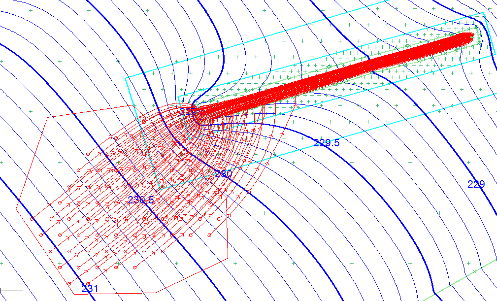
Heads and pathlines in 4-layer model of a remediation trench
3D pathlines are traced from a source area at the water table in a multilayer model. All pathlines are captured by the permeable trench with a well at the downgradient end.
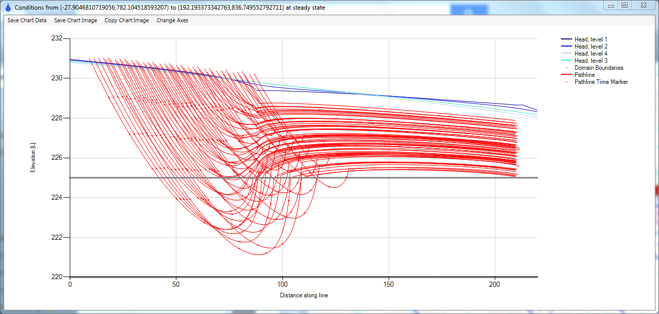
Vertical profile of pathlines and heads in remediation trench simulation
3D pathlines are shown for the remediation trench. Layer boundaries are shown in gray, heads in blue, and pathlines in red.
Flexible Layering
Vertical profile through a multi-layer 3D model shows how the layering scheme can change from one area of the model to another, allowing you to concentrate detail and computational effort in the area of interest.
Vertical profile of simulated fresh/salt interface
AnAqSim model with two aquifers separated by an aquitard. Results are compared to SEAWAT and MODFLOW (SWI) results for the same vertical profile (Fitts et al, 2015).
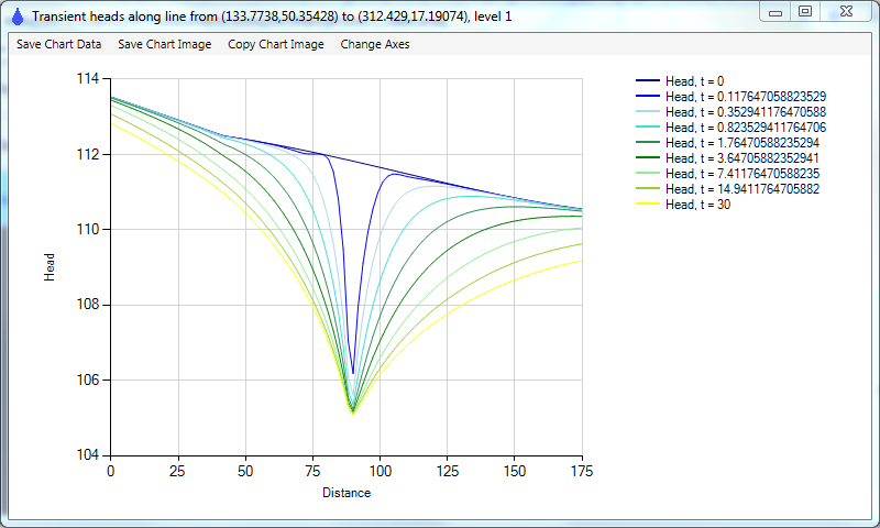
Transient head profiles on a line that crosses a dewatering trench.
This transient multi-layer model simulates response to sudden dewatering to a fixed head along the trench. AnAqSim produces such plots directly.
Head at well vs. time in transient dewatering simulation
Head declines as dewatering system lowers area heads. AnAqSim produces such plots directly.
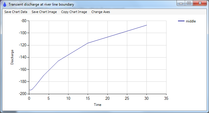
River reach discharge vs. time in transient dewatering simulation
Discharge to nearby river reach declines during simulation of dewatering system. AnAqSim produces such plots directly.
Simulated heads and pathlines in an anisotropic vertical plane flow model
Vertical plane model of flow under an impermeable dam from reservoir (left) to tailwater (right). Aquifer is anisotropic so pathlines are not generally normal to head contours.
Drain line boundary
A polyline drain that transmits water, but has user-specified conductance. Flow along drain is proportional to gradient and the conductance.


